Powered by
  Reach-U
  • HOME
  • SOLUTIONS
    • Demograft
    • MPromoter
    • ALL SOLUTIONS
  • BY INDUSTRIES
    • Telco
    • Smart city
    • Security
  • CUSTOMERS
  • COMPANY
    • Management Report
    • Quality
    • Our Team & Contacts
    • Career
    • R&D projects
    • Our Logo
  • BLOG

Helping our clients to use and valuate location data since 1989

Reach-U EyeVi team spreading their wings

10/11/2020

 
Picture
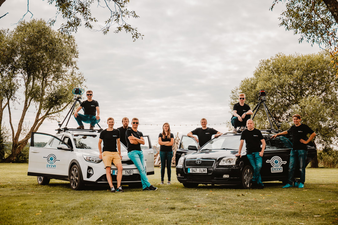
What used to be a small team within Reach-U, has now grown into a fully independent spin-off EyeVi Technologies.
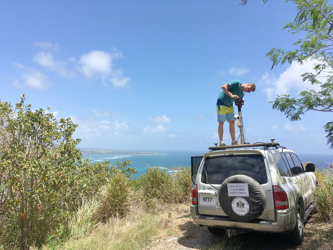
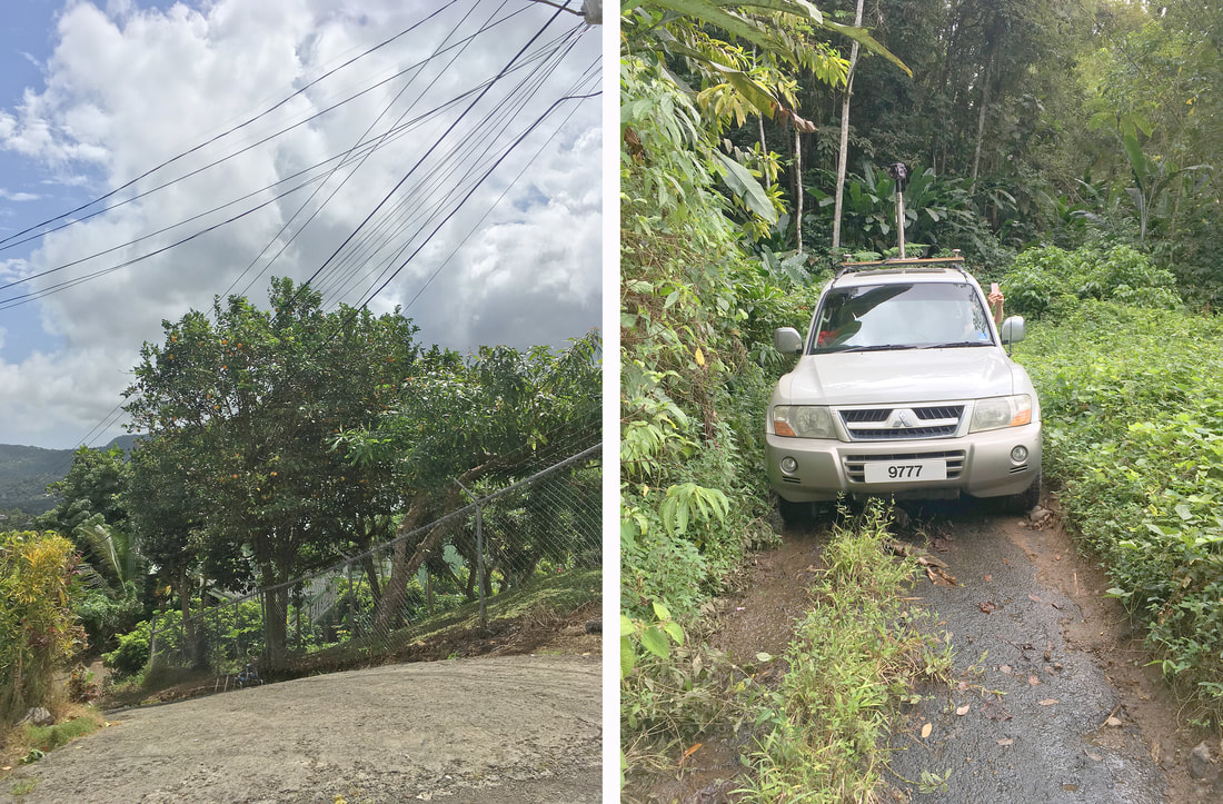
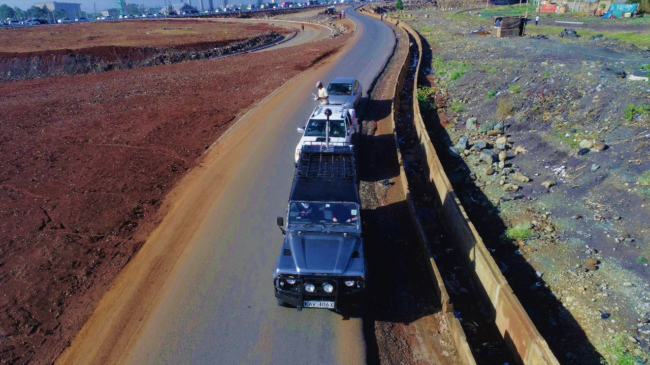
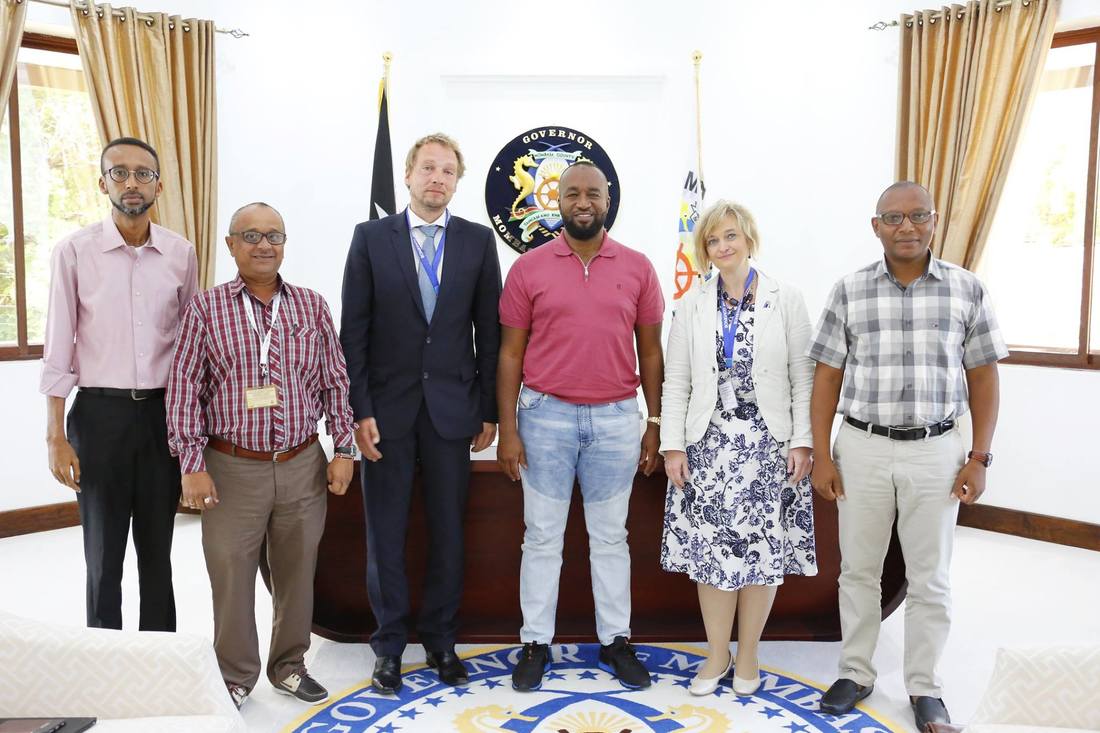
During the years they have already covered most of the roads in Estonia with their 3D mapping technology. They’ve also completed many successful pilot projects across the world, including UK, Finland, USA, Kenya and St Lucia, where the results were beyond expectations. Now it was time for the next step.
Find out how they contributed to the digitization of Finnish road network this summer!

Leading Saint Lucia road management to a new level

3/10/2018

3 Comments

 
Picture
In Q1 2018, the Reach-U EyeVi team completed another successful project, this time in Saint Lucia, one of the Caribbean islands. The project was initiated by the Ministry of Infrastructure, Ports, Energy and Labour of Saint Lucia. The main partners were Finnish companies FinnOC and Sirway, who outsourced our services. As they were already familiar with the EyeVi technology and its benefits, getting the details clear and reaching the deal was only a matter of one phone call and a short meeting. It's a pleasure to have partners that trust our expertise!

The overall goal of the project was to develop and implement a 3D road asset management system covering the road network of Saint Lucia. The system is aimed at improving the efficiency of road maintenance activities, such as planning preventive maintenance, financial planning, managing and monitoring road maintenance works, etc.
​
Reach-U EyeVi team was responsible for collecting and processing input data for the system – determining road pavement type and width, assessing pavement condition (identifying and counting defects), and detecting other road-related objects (road signs, drainage, ditches).

How we did it

​In March, with only one week for preparations, our team packed all their equipment and headed off to Saint Lucia. Right after touching the ground they rushed to the client meeting. Before the end of the day, the vehicle provided by the Ministry was all set with EyeVi equipment, and the gathering of test data started the same evening.
​
During eight days of fieldwork, the EyeVi team covered 650 km of road network, some of it being quite demanding. Although the island is only 40 km long from north to south, the highest point above the sea reaches 950 m. Narrow, curvy and steep mountain roads challenged both the team and the equipment. A decent road changing into a dirt track, narrow dirt roads through banana plantations, and river crossings without a bridge were only a few among all the obstacles that the team faced. A few times the car stopped just a couple of meters away from a cliff! We were fortunate to have an experienced local driver assisting us.
Picture
When all planned areas were covered, the team continued their work in Estonia – during a week-long data processing project, all collected data (panoramas, orthophotos, GPS, and metadata) was finalized. As the next step, the EyeVi web application was remotely installed into the local infrastructure. The data was delivered to the client and added to the hosting network. Together with our partners, we also carried out a training session and workshop for using EyeVi. Based on the feedback from the client, we later made a few UI/UX improvements to ensure that using EyeVi is as smooth as possible.

Use cases and client feedback

Using our solution, the client digitalized all necessary datasets. The system provides them valuable input when planning road works – validating input data is now significantly easier. All tasks that previously required many hours of fieldwork and driving tens of kilometers, can now be completed without even leaving the office. This means significant savings in both time and money. In the future, when we have re-covered the road network, the client can also use the system for supervision.
​
​In the end, the client was very satisfied. The Ministry now has a practical tool for fulfilling the scope of the current project, as well as for future use. We also demonstrated the solution to the Saint Lucia Land Board.
​
​Our partners were happy as well. After completing the project successfully, we have already participated in several other tenders with FinnOC and Sirway.

What's next?

​The project opened up an exciting new lead for us – Road Asset Management Systems. In the last couple of years, dozens of similar systems have been implemented around the world, and it’s a growing trend. In the coming years, these numbers are predicted to climb significantly.
​
EyeVi technology proved to be highly beneficial for collecting input data for the solution. One priority for future projects is automating the entire dataflow (AI-based automatic recognition). New challenges are already waiting for us in India and in Vietnam!
3 Comments

EyeVi goes to the Ring in Budapest

17/11/2017

1 Comment

 
Picture


EyeVi
, a start-up unit within Reach-U has been selected into the best 16 start-ups in Eastern Europe, who has a chance to compete on the podium of “Get in the Ring 2017” event in Budapest. At this unique show, EyeVi team can enter the boxing ring, where in they must “fight” to convince the jury within five rounds, covering topics such as team, achievements, business model, market, and financial and investment proposal.

“We feel honoured to be invited among the 16 final competitors in Budapest”, Gaspar Anton, EyeVi Product Manager, wrote to his team from Smart City Expo World Congress in Barcelona. “Now we have 2 weeks to prepare for a battle and prove to the jury that market is ready for EyeVi technology. Demand we have experienced in Europe, Africa and Asia indicates clearly that it is time for expansion of our activities and offer to the customers the business value EyeVi can provide.”
 
Get in the Ring is the grand finale of a series of international start-up competitions, part of the V4 Start-up and Innovations Fastlane Tour. The project was launched in 2009, initiated by the Erasmus University in Rotterdam, quickly growing from a local event to now a global movement. This year more than 5,000 participating start-ups from 100 countries will compete.

​​EyeVi is a web-based application that allows its users to observe city environment, perform measurements, collect data and share information without leaving the office. It combines up-to-date 360° panoramic images, close range orthophoto, LIDAR scanning data and city’s existing spatial database into 3D city environment.

1 Comment

EyeVi among 50 Best European Start-Ups at EU-Africa Summit in Abidjan

15/11/2017

1 Comment

 
Picture


​EyeVi, a start-up unit within Reach-U has been selected to showcase its services and technology during the 6th EU-Africa Business Forum, on 27 November in Abidjan, Côte d'Ivoire. This unique opportunity enables to showcase EyeVi services and technology to investors and decision makers during a Startup Fair and attend a number of side events dedicated to entrepreneurship, digital economy, energy and agriculture.
 
Ülo Säre, CEO of Reach-U commented: “We are excited to present EyeVi at such an important event. EyeVi technology, offering unique digital GIS referenced and measurable spatial data, opens up completely new possibilities to a broad spectrum of professionals, ranging from road engineers to country and county governments to urban planners and business revenue collection. Africa is important market for us. The response that we have encountered for EyeVi services shows that there is a need for accurate, verifiable and virtually available spatial data."
1 Comment

First ever use of EyeVi on African continent

19/10/2017

1 Comment

 
On October 11, Reach-U launched its first pilot project of EyeVi technology on African continent. Altogether about 50 km of streets around Jogoo Road in Nairobi were captured for a further digitalization.

The pilot was implemented together with ITEC Engineering Ltd., a leading regional consultancy firm specialized in transportation engineering planning, design and management in Kenya.

This is a first step in Reach-U and ITEC Engineering cooperation in making EyeVi permanently available on Kenyan market next year.

The digitalised high-quality images create road attribute and road objects’ inventory and provide stakeholders a measurable understanding of the environment. This will further increase the quality of modern infrastructure planning and execution in the area.
 

Picture
Picture
1 Comment

EyeVi pilot project in Mombasa

13/10/2017

0 Comments

 
Picture

​On October 4, Reach-U Business Development Director, Rait Raal and Estonian Honorary Consul in Kenya, H. E. Kadri Humal-Ayal had an honor to meet Mombasa Governor, Honourable Ali Hassan Joho and his team in Kenya. The meeting was held to discuss mutual cooperation possibilities and solutions for transforming Mombasa into a Smart City – a project for creating innovative urban environment. City planning, traffic management, smart street lighting and tourism were the main discussion areas.
 
It was agreed that during October 16-20, Reach-U will carry out a pilot project by mapping, collecting and digitalizing the data from Mombasa streets with its innovative EyeVi technology. EyeVi combines up-to-date 360° panoramic images, LIDAR scanning data and integrates city’s existing spatial database into 3D city environment. During the pilot in Mombasa, information regarding road conditions, businesses and advertisement spaces in the city are collected in order to identify companies that have not paid their annual business license or advertisement space fees. As a result, the gathered data will enable more effective governance and has a direct impact to County’s revenue.
 
Ülo Säre, CEO of Reach-U commented: „We are thankful for the opportunity to work together with Mombasa County. During the time Reach-U has operated in Africa, Mombasa County has shown the most interest for innovative technologies that improve the services and overall wellbeing in the county for citizens and visitors. As the members of ICT Cluster and Smart City Lab Cluster, we are able to help Mombasa County benefit from the solutions developed by Reach-U and other companies in Estonia. I would like to thank the ICT Cluster and Smart City Lab Cluster for the continuous support and help in this matter.“
 
EyeVi is a web-based application developed by Reach-U that allows its users to observe city environment, perform measurements, collect data and share information without leaving the office. There has been a strong interest for EyeVi technology in Kenya and numerous possible usages for creating more efficient city governance have been already noted.
Picture
0 Comments

    Archives

    January 2021
    November 2020
    July 2019
    October 2018
    August 2018
    November 2017
    October 2017
    December 2016
    January 2016
    December 2015
    November 2015
    October 2015
    September 2015
    February 2014

    Categories

    All
    Annual Report
    Christmas 2015
    Christmas Wish
    Demograft
    Development Team
    EyeVi
    Fleet Management
    Global Mobile Award
    Management Report
    MWC
    Our Team
    Reach-U
    Smart City
    Smart City Expo World Congress

    View my profile on LinkedIn

​Privacy Policy
​
© Reach-U 2022
© Reach-U. All rights reserved.
Picture
  • HOME
  • SOLUTIONS
    • Demograft
    • MPromoter
    • ALL SOLUTIONS
  • BY INDUSTRIES
    • Telco
    • Smart city
    • Security
  • CUSTOMERS
  • COMPANY
    • Management Report
    • Quality
    • Our Team & Contacts
    • Career
    • R&D projects
    • Our Logo
  • BLOG