In Q1 2018, the Reach-U EyeVi team completed another successful project, this time in Saint Lucia, one of the Caribbean islands. The project was initiated by the Ministry of Infrastructure, Ports, Energy and Labour of Saint Lucia. The main partners were Finnish companies FinnOC and Sirway, who outsourced our services. As they were already familiar with the EyeVi technology and its benefits, getting the details clear and reaching the deal was only a matter of one phone call and a short meeting. It's a pleasure to have partners that trust our expertise!
The overall goal of the project was to develop and implement a 3D road asset management system covering the road network of Saint Lucia. The system is aimed at improving the efficiency of road maintenance activities, such as planning preventive maintenance, financial planning, managing and monitoring road maintenance works, etc.
Reach-U EyeVi team was responsible for collecting and processing input data for the system – determining road pavement type and width, assessing pavement condition (identifying and counting defects), and detecting other road-related objects (road signs, drainage, ditches).
How we did it
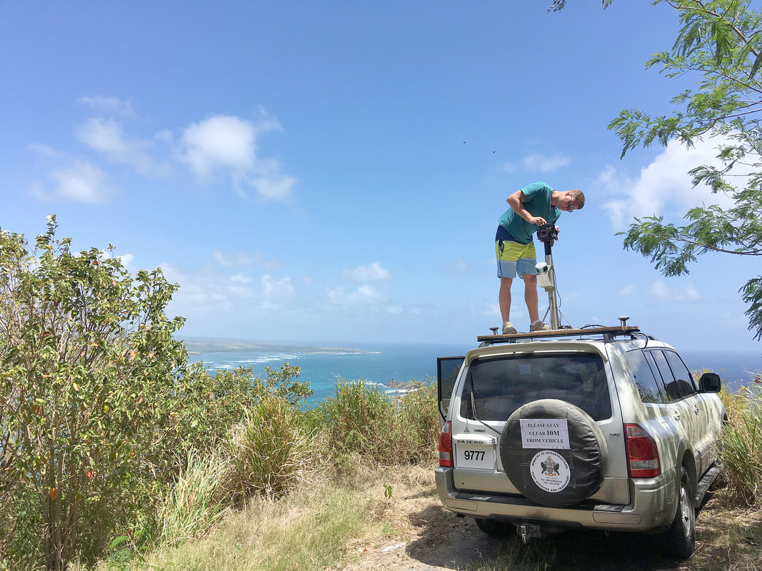
In March, with only one week for preparations, our team packed all their equipment and headed off to Saint Lucia. Right after touching the ground they rushed to the client meeting. Before the end of the day, the vehicle provided by the Ministry was all set with EyeVi equipment, and the gathering of test data started the same evening.
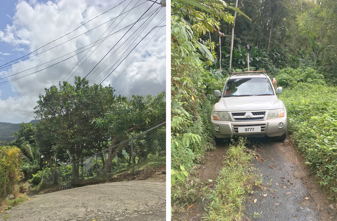
During eight days of fieldwork, the EyeVi team covered 650 km of road network, some of it being quite demanding. Although the island is only 40 km long from north to south, the highest point above the sea reaches 950 m. Narrow, curvy and steep mountain roads challenged both the team and the equipment. A decent road changing into a dirt track, narrow dirt roads through banana plantations, and river crossings without a bridge were only a few among all the obstacles that the team faced. A few times the car stopped just a couple of meters away from a cliff! We were fortunate to have an experienced local driver assisting us.
During eight days of fieldwork, the EyeVi team covered 650 km of road network, some of it being quite demanding. Although the island is only 40 km long from north to south, the highest point above the sea reaches 950 m. Narrow, curvy and steep mountain roads challenged both the team and the equipment. A decent road changing into a dirt track, narrow dirt roads through banana plantations, and river crossings without a bridge were only a few among all the obstacles that the team faced. A few times the car stopped just a couple of meters away from a cliff! We were fortunate to have an experienced local driver assisting us.
When all planned areas were covered, the team continued their work in Estonia – during a week-long data processing project, all collected data (panoramas, orthophotos, GPS, and metadata) was finalized. As the next step, the EyeVi web application was remotely installed into the local infrastructure. The data was delivered to the client and added to the hosting network. Together with our partners, we also carried out a training session and workshop for using EyeVi. Based on the feedback from the client, we later made a few UI/UX improvements to ensure that using EyeVi is as smooth as possible.
Use cases and client feedback
Using our solution, the client digitalized all necessary datasets. The system provides them valuable input when planning road works – validating input data is now significantly easier. All tasks that previously required many hours of fieldwork and driving tens of kilometers, can now be completed without even leaving the office. This means significant savings in both time and money. In the future, when we have re-covered the road network, the client can also use the system for supervision.
In the end, the client was very satisfied. The Ministry now has a practical tool for fulfilling the scope of the current project, as well as for future use. We also demonstrated the solution to the Saint Lucia Land Board.
Our partners were happy as well. After completing the project successfully, we have already participated in several other tenders with FinnOC and Sirway.
What's next?
The project opened up an exciting new lead for us – Road Asset Management Systems. In the last couple of years, dozens of similar systems have been implemented around the world, and it’s a growing trend. In the coming years, these numbers are predicted to climb significantly.
EyeVi technology proved to be highly beneficial for collecting input data for the solution. One priority for future projects is automating the entire dataflow (AI-based automatic recognition). New challenges are already waiting for us in India and in Vietnam!
EyeVi technology proved to be highly beneficial for collecting input data for the solution. One priority for future projects is automating the entire dataflow (AI-based automatic recognition). New challenges are already waiting for us in India and in Vietnam!