Powered by
  Reach-U
  • HOME
  • SOLUTIONS
    • Demograft
    • MPromoter
    • ALL SOLUTIONS
  • BY INDUSTRIES
    • Telco
    • Smart city
    • Security
  • CUSTOMERS
  • COMPANY
    • Management Report
    • Quality
    • Our Team & Contacts
    • Career
    • R&D projects
    • Our Logo
  • BLOG

Helping our clients to use and valuate location data since 1989

Our Intern Stories: Triinu

20/1/2021

 
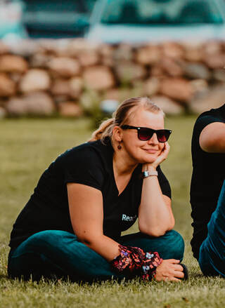
From kindergarten teacher to QA Engineer
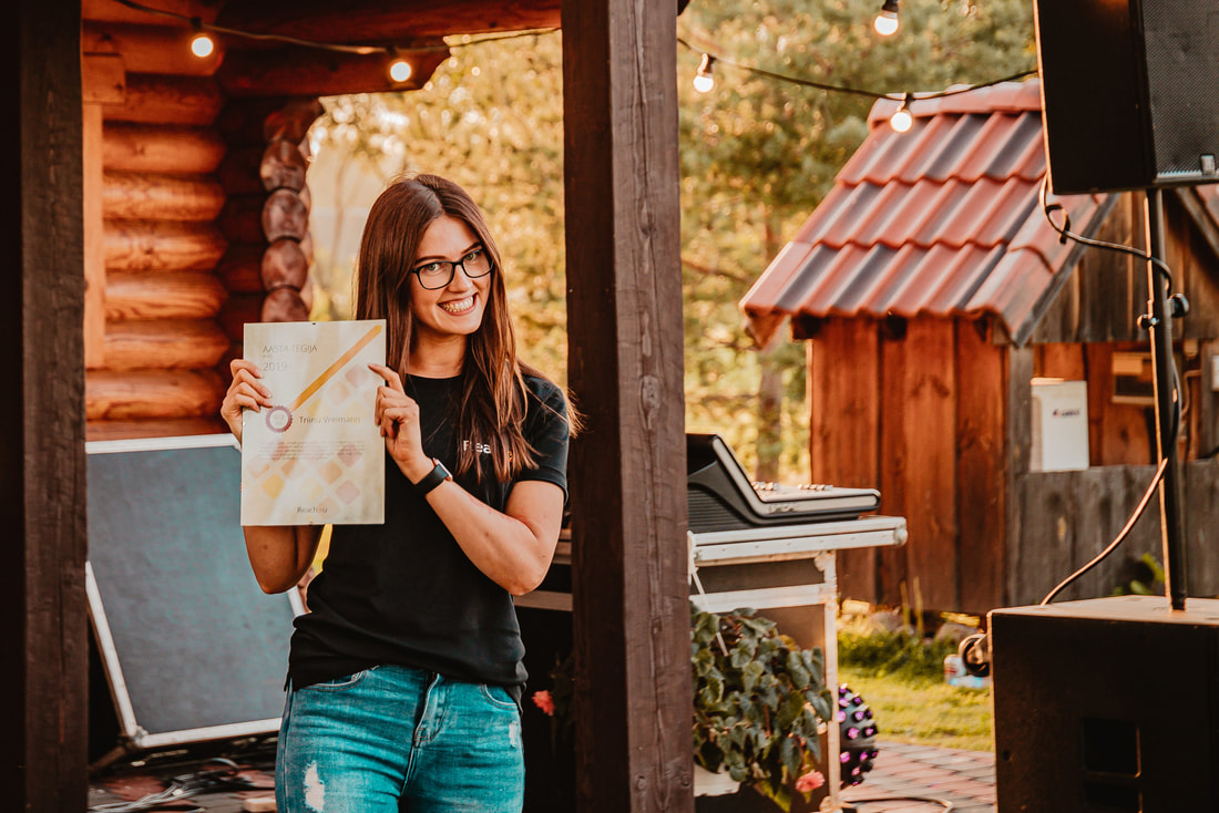
​Triinu joined the forces of Reach-U nearly two years ago but her inspiring story is still worth sharing. She says that changing her career was the best thing she has done, and we couldn’t agree more – last year her colleagues voted her the star of the Alfa team.
Picture
​I started my career as a kindergarten teacher. Soon, after a few years in the education system, I felt that I can't do this my whole life. As rewarding as working with small children is, the stress to pay ratio is just not there. Our kindergarten teachers are true heroes, but as a young, ambitious girl, I felt that I couldn’t do it. So, I decided to quit teaching without any idea what to do next. It was hard saying goodbye to the kids that I had taught for almost 3 years. Leaving gave me a purpose to pull myself together and start looking for new challenges. I had to make it work, otherwise, it would all be in vain.

At first, I started doing online courses in Codecademy and various other places. They seemed interesting, but I knew that I needed something extra to get a real career. Thus I applied for an adult retraining program Vali IT, which educates junior software developers. Luckily, I was accepted to the program and my journey in the IT world started.

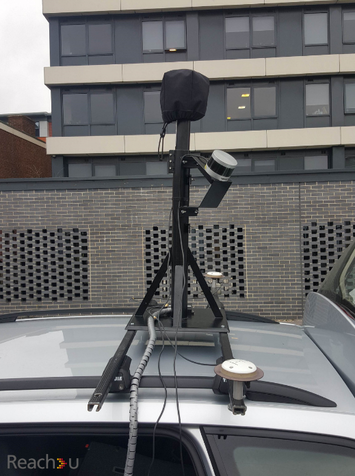
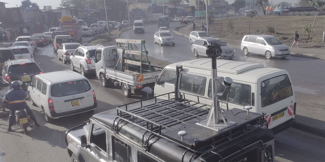
Vali IT program contains two parts. Six-week training in Tallinn and a two-month internship in a real IT company. I was accepted by four companies, but my decision for accepting Reach-U was quite easy. First, it was in Tartu where I live, so no commuting problem. Second, I had heard so much good about the company, as some close friends had been working there for a long time. I was very excited to start my internship as a full-stack developer in team Alfa. I was thrown headfirst into a project of developing a cargo transportation app for a Kenyan logistics company. This included the development of web and mobile app. I couldn't wait to start putting my new knowledge into practice.

As it turned out, it takes a bit more time than 1.5 months to get a grasp of what software development in reality is. The team was very supportive and included me in every step of their work. It was quite demanding at first. No more mischievous children running around, just coffee hyped programmers fixed to the screen all day. But as the months progressed, I started doing some projects in QA engineering. After a few projects, I knew that it suited my personality (nit-picking and being thorough). I knew that this was the route I wanted to pursue.

I worked hard throughout the internship as a junior developer/QA engineer; fingers crossed for an opportunity for a real job. And to my absolute surprise, I landed one. It has been such a great learning experience. I've had 3 job titles in 2 years - kindergarten teacher, junior software developer, and now a QA engineer (for about a year now). Fortunately, during my learning path, I was surrounded by supportive people, so the journey was super pleasant and enjoyable.
​
Changing my career was the best thing I have done. Still can't believe my first choice has turned out so great. It is a pleasure to work with such smart people. Super grateful for Reach-U for the opportunity to work here!

Our Intern Stories: Ann

13/1/2021


From nature conservation biologist to QA Specialist

Reach-U Interns: Ann
Interns have always been welcome at Reach-U. They’re our full-fledged team members from day one – involved in real projects to gain valuable work experience, put into practice everything studied so far, and learn things that can never be taught in a classroom.
​
You may think of a typical intern as an IT-graduate in their early 20’s. Well, you’d be surprised how different our interns’ background is here at Reach-U. Their stories are true evidence that regardless of your education or career background, what truly matters is your inner motivation and willingness to learn and grow continuously.

​Ann joined Reach-U as a QA intern a few months ago. Who would’ve thought a year ago that examining the life of bugs in nature will soon be replaced with chasing bugs in software applications!

This is her story:

Doing an internship with real work experience was my plan for testing out the idea to turn my career around once more (last time it was from a civil servant to nature conservation biologist).
​
It might seem that moving from biological research to software testing is a bit of a leap, but with interest, determination, transferable experience, and a supportive team, it is actually doable! Scientific research has very much in common with testing: gathering and analyzing previous documents, evaluating used data, methods, and results, and finally, communicating found ambiguities and defects.
 
Learning resources for a background in software development and testing are abundantly available but learning does not stick without practice. So, I gathered advice from my friends in the industry and applied for apprenticeships in companies whose products and work environment appealed to me. In Reach-U we agreed on a mutually beneficial plan, and by next Monday I was one of them! Learning the ropes was intense, but that was the intention. Soon I was able to ask questions which turned into bug tasks. One of my first assignments was testing a solution that digitalizes licencing of health care providers – comparison with requirements, checking the design, assessing accessibility, and overall exploratory testing. My previous experience as a solo tester made me appreciate even more the dynamically intertwined development team in Reach-U.  
​
As for testing my idea to become a tester – passed – now I am a Junior QA Specialist! Looking for bugs proves to be a transferable skill!

Reach-U contributing to the digital transformation of the Estonian construction sector

23/11/2020

17 Comments

 
Have you ever come across the process of applying for a construction permit? It can be quite burdensome for all parties involved as getting all the necessary checks done manually requires a significant amount of time and effort. The Estonian Ministry of Economic Affairs and Communications has taken a bold and innovative step of introducing a BIM-based digitalized building permit process in the coming years, thus aiming to increase the productivity of the construction sector.

BIM is a single digital model of a building that includes all the necessary information for architects, engineers, builders, etc. As most of the data is machine-readable, digitalizing the process of reviewing construction permits would save both time and money. Instead of a pile of different construction project documents, all you need is a 3D building information model. Automatic error detection system checks the BIM for possible errors thus allowing the user to make necessary changes already before the application is submitted for manual review.
​
Reach-U has teamed up with a Dutch company Future Insight to make all this happen. We will make sure that the integration of the existing business processes and technological platform will be as smooth as possible!
Picture
17 Comments

Reach-U EyeVi team spreading their wings

10/11/2020

 
Picture
What used to be a small team within Reach-U, has now grown into a fully independent spin-off EyeVi Technologies.
During the years they have already covered most of the roads in Estonia with their 3D mapping technology. They’ve also completed many successful pilot projects across the world, including UK, Finland, USA, Kenya and St Lucia, where the results were beyond expectations. Now it was time for the next step.
Find out how they contributed to the digitization of Finnish road network this summer!

EyeVi Team Participated in Rally Estonia

29/7/2019

0 Comments


​This summer EyeVi team finished first in every single race of Rally Estonia held from 12th to 14th of July on the challenging roads of Southern Estonia. The truth is that we were not there to compete with Ott Tänak or Markko Märtin, but to apply our mobile mapping system (MMS) to record the venue. Car mounted MMS gathers panoramic photos and laser scanned shapes of 3D spaces. The configuration of our Kia was good and the tires performed excellently as did our MMS.

The impulse to participate in Rally Estonia came to us in May when the organizing committee contacted us and invited us to conduct a pilot run. Reach-U’s positive answer to this came immediately as we are convinced that mobile mapping is the way of the future. We had the privilege to go there with a fully open approach: collect enough MMS data to explore all the ways it can be utilized. Our MMS drove all the stages twice. Data collection went smoothly and the postprocessing will be finished soon.
​
Next step is going to be a workshop with the Rally Estonia organizers to collaborate on MMS use cases. We have already discussed using MMS data to monitor the security situation both on the road and in the audience sections. MMS data would also be helpful in the gaming industry, because it gives an accurate input for creating virtual environments. These are just two examples, we hope to find even more use cases.
0 Comments

HD mapping in UK for Ordnance Survey

25/7/2019

3 Comments


Mapping for Ordnance Survey

The need for highly accurate and detailed 3D visual data has grown essentially in several segments. Infrastructure management, city planning, spatial data management, digital twin and BIM are only few segments that already include 3-dimensional content over basic GIS data in their processes.

Automotive industry with the development of autonomous cars, delivery robots and drones will soon grow as one of the major users of this input with the need of HD (high definition) map data services.

One of Reach-U’s core businesses is a mobile-mapping service that combines 360 imagery and 3D LIDAR data together with the AI based feature extraction processes to produce detailed visual intelligence. This year we were chosen by the British Ordnance Survey Ltd to be part of a pilot-project which may turn out to be something much bigger.


Who are they?

Ordnance Survey is a limited company in which the entire share capital is owned by the Department for Business, Energy & Industrial Strategy (BEIS). It is the national mapping agency of Britain and is responsible for the surveying, production, maintenance, and marketing of a wide range of geographic information, relied on by government, business, and individuals.

What they wanted?
OS is looking at how this can be achieved through a methodology that is scalable to a national extent using an innovative, highly efficient and automated technology. An operational solution is therefore sought that will not only facilitate initial data capture and feature extraction but permit rapid and regular update and maintenance.

So, the Ordnance Survey needed service providers to support its investigative work into the potential uses of street-side feature geometry and associated attribution to meet various use cases; CAV (Connected Autonomous Vehicles), radio signal propagation and utility operations for example.


What was the tender about?
The Ordnance Survey decided to start with a small tender, a pilot-project, to collect information about who offers this kind of service and learn about possible ways to scale the tiny project to a nation-wide job. A little bit over a hundred kilometers of road in Romney, Southampton and Bournemouth, England, were chosen for the winners of the tender to show what they are capable of. 

There were four winners, one of them Reach-U. The Ordnance Survey wanted the four chosen participants to present their raw data gathered via mobile mapping in 360 imagery, lidar data, positioning information (GNSS, IMU, Ground Control Points) or any other data captured by the mobile mapping system used.

 
What needed to be mapped?
The Ordnance Survey decided to collect all the information that can be gathered as a 3D vector dataset including road furniture, navigational info, objects and vegetation.

But even they did not know, what kind of information the companies involved are able to get. So, they divided the attributes needed to gather into “mandatory” and “desirable”.  The first was obligatory and the second would be bonus. There were 23 mandatory and 14 desirable attributes. Spoiler alert, though! Reach-U, who have developed their HD-mapping solutions by themselves, did gather information about 37 out of 37 attributes the Ordinance Survey wanted.

Lamp posts, traffic lights, road signs, street signs, bus stops, pedestrian crossings and many other very important factors in everyday road traffic were made mandatory.

Foliage/vegetation, underpasses, bridges, advertising-boards and so on were made “desirable”, because they did not know if it was possible to gather detailed information about these objects.


How did Reach-U do it?
​Gaspar Anton, the EyeVi business Line manager in Reach-U, describes in detail how Reach-U solved the assignment:
​
“After being one of the four winners of the tender, Reach-U needed to work their magic on the 120 kilometers. We packed our technology into a suitcase and flew to Britain. Then we rented a vehicle and attached the mapping system onto the car.
Picture
Picture

Now that we had gathered the raw-data – panoramic images and 3D point cloud – we needed to use them to digitalize the 37 attributes. We had done comprehensive research and development to find a software solution to help us. We chose TopoDot, which is a semi-automatic feature extraction solution based on top of Bentley MicroStation. A person is needed to confirm, change or improve the info given by the software. It took three people a month to verify and confirm 120 kilometers of complex information. Now we had a vector-line with all the necessary information.

Let’s take a curbstone for an example. We now had information of its height and material. Or a traffic sign – there now has information about its type, impact description and direction. And all the features now also include high accurate  3D position information (less than 10cm x,y,z). That’s what we gave to the Ordnance Survey.
​
Reach-U have bought together what others might call toys and develop them so that top of the notch mobile-mapping can be done as cost-effectively as possible. It is important, because if you want self-driving vehicles to drive on your roads then you need to map the whole country the way UK wants to do it and keep it constantly updated. We are using the same technology and equipment to map right now about 41 000 kilometers of Estonian roads in 2019.


Read more about the solution or our projects from EyeVi.

​Get in contact with us:
Gaspar Anton
| Business Line Manager
[email protected] | Mob: +372 5330 9423
www.reach-u.com|Reach-U


3 Comments

Reducing operative fleet costs with AVL in Reach-U EyeVi mobile mapping projects

24/10/2018

0 Comments

 
We interviewed our EyeVi Business Line Manager to find out how they increase the efficiency of their fleet during mobile mapping projects. Here’s a little hint – they use our own fleet management and monitoring solution AVL (Asset and Vehicle Location).
EyeVi mobile mapping in Kenya
EyeVi team mobile mapping in Kenya
What is EyeVi?
EyeVi is a web-based application that allows its users to observe urban or rural environments, perform measurements, collect data, and share information without leaving the office. To create this virtual environment, we use technology that combines 360° panoramic images, close-range orthophoto, LIDAR scanning data, and the city’s existing spatial database into a 3D urban environment. All three types of views are collected with our own car-mounted mobile mapping system.

Why AVL?
We have used AVL for managing our fleet in several Reach-U EyeVi mobile mapping projects, and it has increased our work efficiency significantly. Using AVL helps us to cover more kilometers in shorter timeframes, while also keeping our vehicles safe, and maintaining a reasonable workload for our project manager. 

How does the project manager use AVL?
Each morning, the project manager wants an instant overview of where the vehicles are, and what their status is. When looking at the map, the project manager has a complete overview of the locations of vehicles at any time. But creating and assigning geofences to vehicles also allows the manager to receive notifications about various events that may otherwise go unnoticed.

In our case, every morning the project manager assigns an area to be covered for each vehicle, and creates the corresponding geofence – also adding a time period when the vehicle must be in the area. When a vehicle enters or leaves the working area, the project manager receives an immediate notification. Geofences are also created for each vehicle's night-time parking place (driver’s home, secured parking lot, etc.). This enables the project manager to get notifications when a vehicle has arrived safely at its after-hours parking spot, or if the vehicle disappears unexpectedly.
​
Different notification channels are defined based on the importance of events. For critical events (for example, a vehicle leaving a parking lot after hours) the notifications are sent directly to the project manager’s smart phone as SMS; for informative events (such as vehicles entering the working area in the morning) the notifications are sent only via email.


EyeVi equipment is said to be somewhat sensitive to clouds and bad weather. How do you cope with that?
Good weather conditions play an important role in successful mobile mapping with EyeVi equipment. Fortunately, AVL enables users to combine different map layers, so they can easily consider the weather information when planning the routes and re-routing vehicles. For example, if the project manager notices that the working area assigned to a vehicle will be covered with thick clouds in a few hours, he can select a new area on the map and send the information to the driver. The driver receives a notification specifying the new area, as well as what time they should start covering the area, and can continue working smoothly despite changing weather conditions.
Integrating weather information is only one example – similar integrations can also be done with other datasets.

Are there any other useful tools in AVL?
Fast and accurate information exchange between the project manager and the drivers is highly important. This is another part of the workflow where AVL can help. In addition to the information about changing weather conditions and new working areas, the project manager can also inform drivers about a common meeting place and time, or a service appointment, etc.
​
AVL is also helpful in solving unexpected problems, for example if a vehicle runs out of fuel in a remote area. The project manager can send help to the vehicle by finding and contacting another nearby vehicle, and providing directions to its driver. Monitoring both vehicles on the map in real time makes the task much simpler.

How can the project manager keep track of the whole project?
Various reports give the project manager a detailed overview of the project's status. For example:
  • What is the total time and distance driven?
  • How many unique kilometers were covered within a day?
  • How much time did the vehicles spend in the parking lots and in service?
  • What is the fuel consumption of each vehicle?
  • How much of the planned area has already been covered?
  • What is the estimated time to cover the entire planned area?
These are the main reports that our project manager needs. Based on a specific project, we can also create custom reports.

How would you summarize the benefits of using AVL?
  • Increased vehicle security
  • Overview of vehicles’ locations at any time
  • Increased work efficiency of both the fleet manager and the drivers/vehicles​

AVL is a fleet management and monitoring tool  that increases the efficiency and safety of vehicle parks. While managing a vehicle park, it is crucial to have a good overview of the journey routes, to keep an eye on both the driver's real-time activities and the condition of the equipment. It does not matter if it is trucks or taxis – with AVL you will always have the necessary information.

Find out more at: ​http://www.reach-u.com/asset-and-vehicle-location.html
​

Want to know how AVL can help solve your own fleet management challenges? Get in touch with us at [email protected]
0 Comments

Leading Saint Lucia road management to a new level

3/10/2018

3 Comments

 
Picture
In Q1 2018, the Reach-U EyeVi team completed another successful project, this time in Saint Lucia, one of the Caribbean islands. The project was initiated by the Ministry of Infrastructure, Ports, Energy and Labour of Saint Lucia. The main partners were Finnish companies FinnOC and Sirway, who outsourced our services. As they were already familiar with the EyeVi technology and its benefits, getting the details clear and reaching the deal was only a matter of one phone call and a short meeting. It's a pleasure to have partners that trust our expertise!

The overall goal of the project was to develop and implement a 3D road asset management system covering the road network of Saint Lucia. The system is aimed at improving the efficiency of road maintenance activities, such as planning preventive maintenance, financial planning, managing and monitoring road maintenance works, etc.
​
Reach-U EyeVi team was responsible for collecting and processing input data for the system – determining road pavement type and width, assessing pavement condition (identifying and counting defects), and detecting other road-related objects (road signs, drainage, ditches).

How we did it

​In March, with only one week for preparations, our team packed all their equipment and headed off to Saint Lucia. Right after touching the ground they rushed to the client meeting. Before the end of the day, the vehicle provided by the Ministry was all set with EyeVi equipment, and the gathering of test data started the same evening.
​
During eight days of fieldwork, the EyeVi team covered 650 km of road network, some of it being quite demanding. Although the island is only 40 km long from north to south, the highest point above the sea reaches 950 m. Narrow, curvy and steep mountain roads challenged both the team and the equipment. A decent road changing into a dirt track, narrow dirt roads through banana plantations, and river crossings without a bridge were only a few among all the obstacles that the team faced. A few times the car stopped just a couple of meters away from a cliff! We were fortunate to have an experienced local driver assisting us.
Picture
When all planned areas were covered, the team continued their work in Estonia – during a week-long data processing project, all collected data (panoramas, orthophotos, GPS, and metadata) was finalized. As the next step, the EyeVi web application was remotely installed into the local infrastructure. The data was delivered to the client and added to the hosting network. Together with our partners, we also carried out a training session and workshop for using EyeVi. Based on the feedback from the client, we later made a few UI/UX improvements to ensure that using EyeVi is as smooth as possible.

Use cases and client feedback

Using our solution, the client digitalized all necessary datasets. The system provides them valuable input when planning road works – validating input data is now significantly easier. All tasks that previously required many hours of fieldwork and driving tens of kilometers, can now be completed without even leaving the office. This means significant savings in both time and money. In the future, when we have re-covered the road network, the client can also use the system for supervision.
​
​In the end, the client was very satisfied. The Ministry now has a practical tool for fulfilling the scope of the current project, as well as for future use. We also demonstrated the solution to the Saint Lucia Land Board.
​
​Our partners were happy as well. After completing the project successfully, we have already participated in several other tenders with FinnOC and Sirway.

What's next?

​The project opened up an exciting new lead for us – Road Asset Management Systems. In the last couple of years, dozens of similar systems have been implemented around the world, and it’s a growing trend. In the coming years, these numbers are predicted to climb significantly.
​
EyeVi technology proved to be highly beneficial for collecting input data for the solution. One priority for future projects is automating the entire dataflow (AI-based automatic recognition). New challenges are already waiting for us in India and in Vietnam!
3 Comments

Let's talk about geodata services!

30/8/2018

0 Comments

 
Picture
In the August issue of e-Estonia newsletter our Business Development Manager Ülari Teder discusses the recent shocking price changes in Google Maps API pricing model – who are affected by the changes and why to look for alternatives. Here’s a little spoiler alert – we have a solution!

Ülari also explaines what is our soon-to-be-launched platform Baltic Geodata Marketplace and gives a sneak peek into our plans for the future.
​
Read the full story HERE.
0 Comments

EyeVi goes to the Ring in Budapest

17/11/2017

2 Comments

 
Picture


EyeVi
, a start-up unit within Reach-U has been selected into the best 16 start-ups in Eastern Europe, who has a chance to compete on the podium of “Get in the Ring 2017” event in Budapest. At this unique show, EyeVi team can enter the boxing ring, where in they must “fight” to convince the jury within five rounds, covering topics such as team, achievements, business model, market, and financial and investment proposal.

“We feel honoured to be invited among the 16 final competitors in Budapest”, Gaspar Anton, EyeVi Product Manager, wrote to his team from Smart City Expo World Congress in Barcelona. “Now we have 2 weeks to prepare for a battle and prove to the jury that market is ready for EyeVi technology. Demand we have experienced in Europe, Africa and Asia indicates clearly that it is time for expansion of our activities and offer to the customers the business value EyeVi can provide.”
 
Get in the Ring is the grand finale of a series of international start-up competitions, part of the V4 Start-up and Innovations Fastlane Tour. The project was launched in 2009, initiated by the Erasmus University in Rotterdam, quickly growing from a local event to now a global movement. This year more than 5,000 participating start-ups from 100 countries will compete.

​​EyeVi is a web-based application that allows its users to observe city environment, perform measurements, collect data and share information without leaving the office. It combines up-to-date 360° panoramic images, close range orthophoto, LIDAR scanning data and city’s existing spatial database into 3D city environment.

2 Comments
<<Previous

    Archives

    January 2021
    November 2020
    July 2019
    October 2018
    August 2018
    November 2017
    October 2017
    December 2016
    January 2016
    December 2015
    November 2015
    October 2015
    September 2015
    February 2014

    Categories

    All
    Annual Report
    Christmas 2015
    Christmas Wish
    Demograft
    Development Team
    EyeVi
    Fleet Management
    Global Mobile Award
    Management Report
    MWC
    Our Team
    Reach-U
    Smart City
    Smart City Expo World Congress

    View my profile on LinkedIn

​Privacy Policy
​
© Reach-U 2022
© Reach-U. All rights reserved.
Picture
  • HOME
  • SOLUTIONS
    • Demograft
    • MPromoter
    • ALL SOLUTIONS
  • BY INDUSTRIES
    • Telco
    • Smart city
    • Security
  • CUSTOMERS
  • COMPANY
    • Management Report
    • Quality
    • Our Team & Contacts
    • Career
    • R&D projects
    • Our Logo
  • BLOG